Menu:
Wesleyan Campus Orienteering Courses
This page: http://pierce.wesleyancollege.edu/faculty/MSP/orientex/courses.html
For this exercise you will navigate one of six orienteering courses set up across the Wesleyan College campus.
Materials needed:
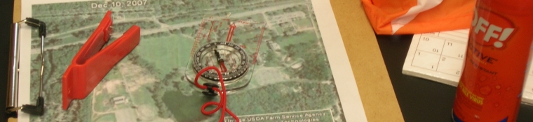
compass
GPS unit
clipboard and pen or pencil
water bottle - you will be on the course for 30-60 minutes
insect repellant
watch
course record card
aerial map of the front campus
Part I - Orienting your maps
1) The starting location for all of the courses is the East post of the MSC sign on the campus side of the Munroe Science Center plaza. Mark This location on both of your maps with the letter "S".
2) You will use the straight sidewalk running between Taylor, MSC, and Tate as a reference. Establish a bearing to the east-southeast along one edge of the sidewalk. Find the image of the sidewalk on the aerial map.
3) On the aerial map line up one straight edge of your compass with the image of the sidewalk. Keeping the map flat to the ground, rotate the map until the compass needle lines up with its outline in the compass bezel. Now slip your protractor under the compass and line up its straight edge with one the parallel red N-S meridian lines. Draw an ~ 1" line along the edge of the protractor over the forested area of the map. This line should run magnetic north-south. Draw an arrowhead on the north end of this line and label it "N". You can now use this North directional line and your compass to orient your map to the earth at any time.
4) Draw a similar arrow pointing approximately north on the schematic campus guide map. If you keep these two maps oriented roughly the same way you can use the labeled guide map to identify buildings and major features on the aerial photo map.
Part II - Completing the course
1) Make sure that you use insect repellant on your ankles and take adequate water with you on this course. If you feel unwell at any time, rest in the shade nad return to the MSC building when you can.
2) Work in a group with 1 or 2 other students. Fill in your group name on the course record card. Choose one of the courses below and write that somewhere on the card.
3) When you are ready to start, fill in the start time and navigate your way around the course, using the heading directions and distances below.
4) The exact location of each waypoint is designated by an orange and white nylon marker "kite". As you reach each waypoint:
a) write the waypoint letter in the appropriate box on the record card,
b) use the red punch to perforate the center of the box,
c) jot down a quick description of the waypoint location,
d) take a GPS reading over the marker kite and record these coordinates, and
e) mark the exact location of the waypoint on your aerial map.
5) When you reach the sixth waypoint you are finished. This waypoint should look strangely/comfortingly familiar to you. Record the finish time on your record card and calculate your elapsed time.
Part III - Mapping the course
1) Using your protractor or compass as a straight-edge, plot your course on the aerial map, using arrows to indicate the direction of travel.
2) Label each waypoint on the map with its designator letter.
3) Check your course map against the course set up guide to see how you did.
Course Directions
| Course 1A | Course 1B |
| S | S | |||||
| W1 | 102o | 241 meters | W1 | 207o | 61 meters | |
| W2 | 212o | 171 meters | W2 | 293o | 118 meters | |
| W3 | 251o | 112 meters | W3 | 142o | 282 meters | |
| W4 | 322o | 282 meters | W4 | 71o | 112 meters | |
| W5 | 113o | 118 meters | W5 | 32o | 171 meters | |
| W6 | 27o | 61 meters | W6 | 282o | 241 meters |
| Course 2A | Course 2B |
| S | S | |||||
| W1 | 182o | 273 meters | W1 | 253o | 143 meters | |
| W2 | 243o | 112 meters | W2 | 206o | 36 meters | |
| W3 | 328o | 219 meters | W3 | 229o | 97 meters | |
| W4 | 49o | 97 meters | W4 | 148o | 219 meters | |
| W5 | 26o | 36 meters | W5 | 63o | 171 meters | |
| W6 | 73o | 143 meters | W6 | 2o | 112 meters |
| Course 3A | Course 3B |
| S | S | |||||
| W1 | 223o | 268 meters | W1 | 299o | 105 meters | |
| W2 | 311o | 237 meters | W2 | 246o | 102 meters | |
| W3 | 15o | 166 meters | W3 | 312o | 175 meters | |
| W4 | 132o | 175 meters | W4 | 195o | 166 meters | |
| W5 | 66o | 102 meters | W5 | 131o | 237 meters | |
| W6 | 119o | 105 meters | W6 | 43o | 268 meters |
Back to Orienteering Main Page
Rev. 6.10